Maps

The Texas Hill Country: A home worth protecting
Created in 2023, this double-sided map spotlights the 17 counties of the Hill Country while also placing a particular emphasis on the region’s scenic beauty – it’s flowing rivers, historic town squares, open spaces, and starry skies. Since there are a few features depicted on this map that warrant additional explanation, additional information about the map and the Hill Country Alliance’s work is shown on the back. This map is available for sale as an 18x24in print with proceeds benefitting the Hill Country Alliance – click to learn more.

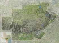
HCA’s Map of the Texas Hill Country
This map shows a particular emphasis on Hill Country watersheds and aquifer recharge zones, created by Siglo Group using GIS data. This map is available for sale as a 2x3ft print with proceeds benefitting the Hill Country Alliance – click to learn more.
Hill Country Maps:
Where is the Texas Hill Country?
National Conservation Easement Database
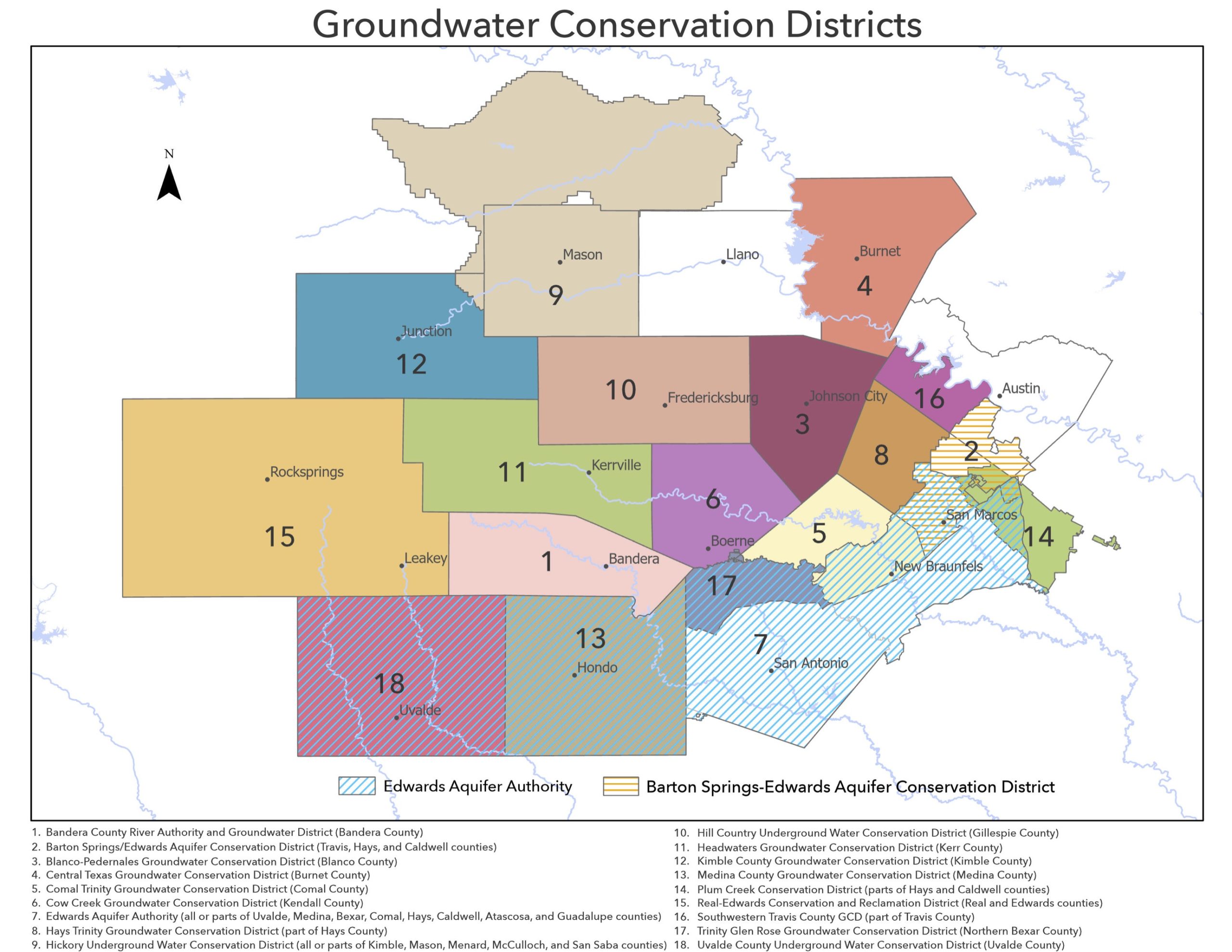
Hill Country Groundwater Conservation Districts (2023)
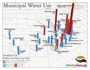
A map of various Hill Country communities and their water use on a gallons per person per day scale. Note that the Texas Water Development Board recommends a 140 gallons per person per day goal.
Hill Country Water Pipeline Map
Map of proposed and existing water transmission pipelines across the Hill Country.
Texas Hill Country
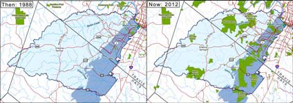
Then & Now: Protected Land of the Barton Springs Edwards Aquifer
Land conservation advances over time for the Barton Springs recharge Zone
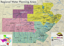
Regional Planning Areas
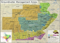
Hill Country Groundwater Management Areas (GMAs)
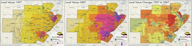
Land Values 1997 – 2007
Information compiled by the “Land Trends” project and based on tax information collected by the state comptrollers office regarding the value of land per acre in each school district. The three maps include: 1) value per acre in 1997, 2) value per acre in 2007, and 3) percentage change in value from 1997 to 2007. The maps show substantial gains in land values with the higher values reaching further into the interior of the Hill Country. Many land valued doubled and tripled in value and some areas even quadrupled in value.
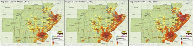
Regional Growth 2010 – 2100
Data taken from Texas State Assessment of Forest Resources Draft 26 Sept 2008. Data layer uses available data to project likely development patterns into the future. Data used for the evaluation included projected population growth and current land use patterns. The study covered the entire Southearstern United States and looked at per decade growth from 2010 to 2100.
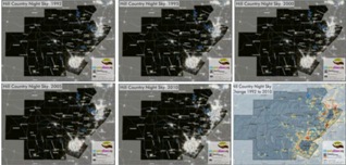
Hill Country Night Skies 1992 – 2010
The Hill Country Night Skies map set is a set of 6 maps showing the evening light intensity of the Hill Country in 1992, 1995, 2000, and 2010. The final map shows the change in intensity from 1992 to 2010. Data collected by the National Oceanic and Atmospheric Administration.
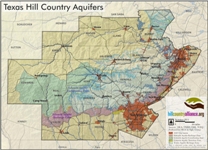
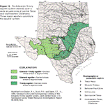
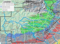
Hill Country Aquifers
Zoning map of the Edwards and Trinity aquifers
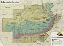
Edwards Aquifer
Zoning map of the Edwards Aquifer
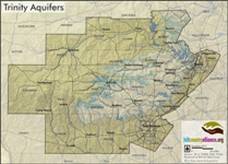
Trinity Aquifers
Zoning map of the Trinity Aquifers
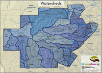
Hill Country Watersheds
Major Hill Country Watersheds
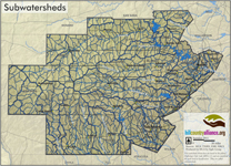
Subwatersheds
Minor Hill Country Watersheds
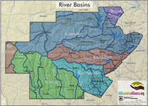
Riverbasins
Riverbasins of the Texas Hill Country
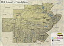
Floodplains
Hill Country Floodplains
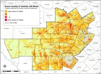
Scenic Quality and Visibility GIS Model
Visibility measured from public roads and waterways
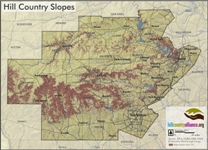
Slopes
Hill Country Slopes greater than 15%
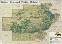
Golden Cheeked Warbler Habitat
Potential Golden Cheeked Warbler Habitat throughout the Texas Hill Country
Aquifers 2
Alternate map of the Edwards and Trinity Aquifers
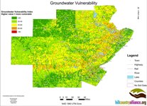
Groundwater Vulnerability
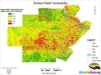
Surface Water Vulnerability
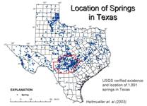
Springs
Texas Hill Country Springs
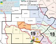
River Authorities
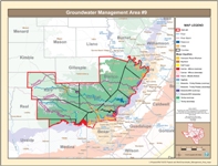
Groundwater Management Area 9
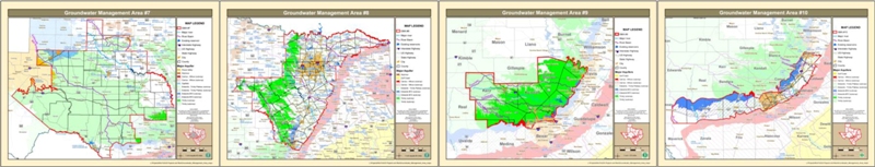
There are 16 Groundwater Management Areas in Texas. All of GMA 9 is located in the Texas Hill Country as well as parts of GMA 7, 8 and 10.
Groundwater Management Areas 7 through 10
Aquifers 3
Alternate map of the Edwards and Trinity Aquifers
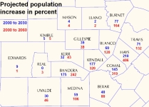
Population Increases
Projected Population increases
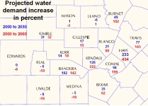
Water Demand Increases
Projected increases to water demand in the Hill Country
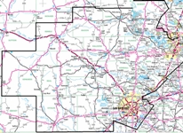
Hill Country Roadways
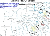
Minimum Stream Flow
Represents minimum flow conditions for Hill Country Streams. Every stream and spring in the area has been dry except San Marcos Springs and Barton Springs.
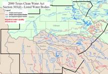
Impaired Surface Water Quality in 2000
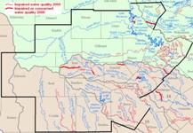
Courtesy of Raymond Slade
Impaired Surface Water Quality in 2006
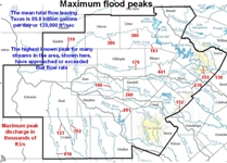
Maximum Flood Peaks
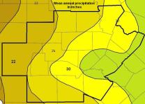
Annual Precipitation