
“Natural springs play the major role in sustaining flows in rivers located in a semi-arid climate that experiences extended dry periods,” said Ron Green, the SwRI scientist who led the research. “This study clearly illustrates the linkage of groundwater flow with surface-water flow in the Edwards-Trinity Aquifer located within the Devils River watershed.”
The headwaters to the Devils River are located in Crockett, Schleicher and Sutton counties, semi-arid landscapes with limited development. The Devils River runs 93 miles southwest into Val Verde County and Lake Amistad near the border with Mexico in southwest Texas. As a key tributary of the Rio Grande, the river provides essential freshwater flows to South Texas and the Rio Grande Valley… Read more from Phys.org
Study links groundwater with surface water in Devils River
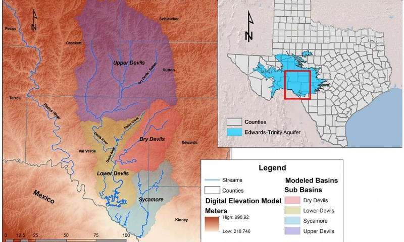
A Southwest Research Institute (SwRI) study provides detailed models linking groundwater in a Texas aquifer to the surface flows in one of the state’s most pristine rivers. The study shows how karstic pathways of the Edwards-Trinity Aquifer follow the same channels as the Devils River watershed, creating natural springs that sustain the river.